


Zoom Earth is a premier weather application that provides an interactive map of global weather conditions, including real-time hurricane tracking and high-definition satellite imagery. The app aggregates data from multiple sources such as NOAA GOES, JMA Himawari, and NASA satellites to deliver near real-time updates on weather patterns.
In addition to its core functionality, Zoom Earth offers users the ability to view detailed forecasts for rain, wind, temperature, and atmospheric pressure. This makes it an invaluable tool for those needing accurate weather information for travel, outdoor activities, or emergency preparedness.
One of the standout features of Zoom Earth is its comprehensive weather forecasting capabilities. Users can explore precipitation forecasts, wind speed and gust predictions, temperature maps, and more. These forecasts are powered by leading meteorological models like DWD ICON and NOAA/NCEP/NWS GFS, ensuring precision and reliability.
The app also includes advanced customization options, allowing users to adjust units of measurement, time zones, and animation styles. With the Zoom Earth Pro subscription, additional premium features become available, enhancing the overall user experience with more detailed analytics and extended functionalities.
When it comes to weather applications, forecast accuracy and data credibility are paramount. Zoom Earth excels in these areas by providing continually updated weather forecast maps with the latest model data from reputable sources like DWD ICON and NOAA/NCEP/NWS GFS.
The app offers a suite of forecast maps covering precipitation, wind speed and gusts, temperature, 'feels like' temperatures, wet bulb temperatures, relative humidity, dew point, and atmospheric pressure. This comprehensive approach ensures that users have access to detailed and reliable information about impending weather conditions.
Zoom Earth's use of high-quality satellite imagery updated in near real-time from satellites such as NOAA GOES, JMA Himawari, and EUMETSAT Meteosat further enhances the accuracy of its forecasts. The images allow users to track the development of dynamic weather systems, including hurricanes and storms, ensuring they stay informed about potential weather threats.
By combining sophisticated forecasting models with timely satellite data, Zoom Earth delivers precise and credible weather information, empowering users to make well-informed decisions based on trustworthy meteorological data.
Another critical aspect of weather forecasting is the temporal and spatial range of predictions. Zoom Earth provides an extensive forecast range that allows users to explore weather conditions not only in their immediate vicinity but also across the globe.
Through interactive weather maps, users can view various meteorological phenomena such as rain, wind, temperature, and pressure. These maps offer both short-term nowcasts using Doppler radar for rain and snow and longer-term forecasts for different weather parameters.
In addition to ground-based radar data, Zoom Earth incorporates satellite imagery that is updated multiple times throughout the day. This includes live updates every 10 minutes from geostationary satellites and twice-daily updates from polar-orbiting satellites, delivering a broad spatial coverage that helps monitor wildfires, smoke movement, and other large-scale environmental events.
This combination of wide-ranging temporal forecasts and expansive spatial data ensures that Zoom Earth users have a complete picture of global weather patterns, enhancing situational awareness and preparedness for whatever nature may bring.
User-friendly interface
Real-time updates
Comprehensive weather data
High-definition satellite images
Customizable settings
Premium features require subscription
Limited offline functionality
Occasional data delays
Resource-intensive
Complex for beginners

Accurate weather forecast and beautiful weather & clock widgets
 4.20
4.20
Local weather forecast, reliable daily weather report
4.30
Your local weather app with storm radar, rain tracker, weather maps & AQI.
4.5
72-hour weather & daily forecasts with extreme weather alerts
4.60
3D Animation Weather Icon
4.00
Accurate, beautiful weather with landscapes depicting weather, sky, season.
4.50
Determine Best Hunting Times for any date, any location.
2.50
Magnetic Compass meets smart tech: Get directions and weather alerts seamlessly
3.30
Stay Ahead Of Changing Weather Conditions
4.00
Weather for Indiana, Kentucky and Ohio
4.90
My Tide Times Pro is the only tide tables and forecasts application you'll need.
4.80
Weather Forecast, Trending News, Hurricane & Storm Tracker, Alerts & Live Radar.
4.80
Live Alabama weather from James Spann—forecasts, radar, alerts, Spanncams.
4.70
Industry leading whitetail movement predictor & hunting app.
4.60
Weather radar map, storm tracker, local forecast, live rain alerts & daily news.
4.60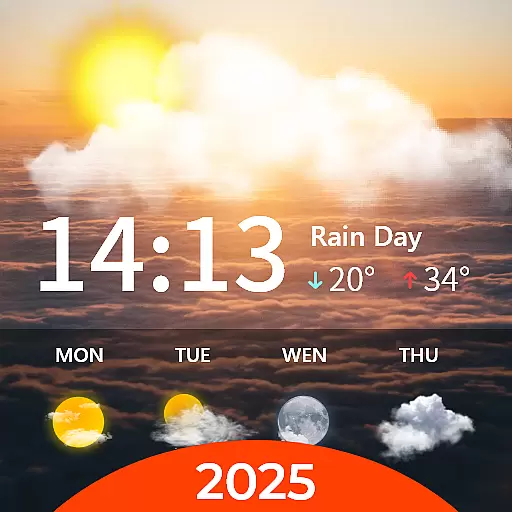
Your Personal Weather Assistant
4.00
A powerful weather forecast to get real-time weather information
3.60
Quickly check the Hanalei river gauge height during heavy rains on Kaua'i.
4.1
Dynamic weather watch face with glass effect, bold time & 7 complications.
4.5


User Reviews