
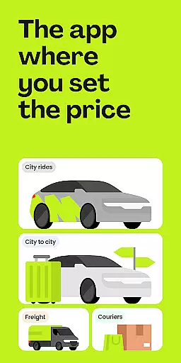
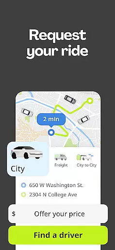
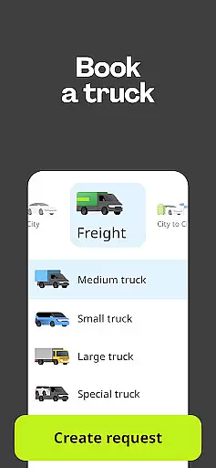
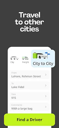
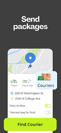
inDrive is a versatile rideshare app that offers more than just urban taxi services. It allows users to negotiate fares directly with drivers, ensuring fair pricing without surge charges. The app also extends its services beyond ridesharing, providing options for intercity travel, package delivery through its courier service, freight solutions, and even local task assistance.
Available in over 888 cities across 48 countries, inDrive empowers both customers and service providers by giving them control over their transactions. Customers can easily find rides or other needed services while drivers benefit from flexible working conditions and the freedom to choose which jobs to accept based on rider drop-off locations and proposed fares.
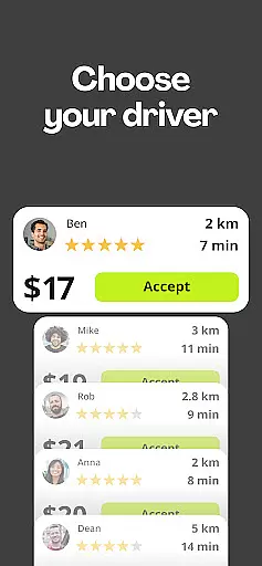
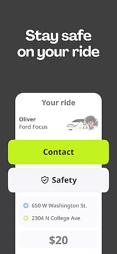
The true value of inDrive lies in its commitment to safety, transparency, and user empowerment. By allowing users to select drivers based on various criteria such as car model and rating, it sets itself apart from traditional taxi apps. Additionally, features like 'Share Your Ride' enhance passenger security during trips.
One of the standout features of inDrive is its negotiation-based fare system. Unlike typical ride-hailing apps, inDrive lets passengers propose their fare for a trip, and drivers can either accept or counteroffer. This ensures competitive pricing and eliminates unexpected surge pricing scenarios.
Beyond standard city rides, inDrive offers specialized services including intercity travel, courier deliveries up to 20 kilos, freight transportation, and tasker services. Each service is designed to cater to different customer needs, whether it's moving between cities or sending packages across town.
Safety and customization are at the forefront of inDrive’s feature set. Users can view detailed driver information before confirming a ride, share live trip data with contacts for added security, and specify additional ride preferences in a comments section. These aspects contribute to a personalized and secure experience for all users.
Map accuracy is a critical feature for any navigation app, and inDrive excels in this area. The application provides precise location data that ensures users can find rides and services without confusion or errors. This precision is achieved through advanced mapping technologies that update in real-time, reflecting the most current road conditions and city layouts.
inDrive's dedication to accuracy means that whether you're traveling within your city or between cities, you can trust the app to guide you correctly. The detailed maps allow users to enter exact pickup and drop-off points, ensuring drivers can locate them effortlessly. This level of detail extends to remote areas, where other map services might lack information.
For drivers and couriers using inDrive, accurate maps mean they can accept jobs with confidence, knowing exactly where they need to go. This reduces travel time and increases efficiency, allowing service providers to complete more jobs in less time. Moreover, clear mapping contributes to safer journeys as it minimizes the chances of getting lost or encountering unexpected obstacles.
Ultimately, the high standard of map accuracy in inDrive enhances user experience by providing reliable navigation tools. Users benefit from seamless interactions, whether they are commuting, sending packages, or booking freight services. With trustworthy maps at their fingertips, both customers and service providers enjoy peace of mind and smooth transactions.
Route planning is an essential aspect of inDrive's functionality, offering users intelligent solutions for navigating from point A to B efficiently. By leveraging sophisticated algorithms, the app calculates optimal routes based on various factors such as traffic patterns, road closures, and estimated travel times. This ensures that every trip is as swift and hassle-free as possible.
The app's route planning capabilities extend beyond basic navigation. For intercity travel, inDrive considers multiple variables to suggest the best paths, including highways versus local roads and toll costs. This comprehensive approach allows users to make informed decisions about their journeys, balancing speed with cost-effectiveness according to their preferences.
Drivers utilizing inDrive also benefit significantly from its route planning features. They receive detailed guidance on the most efficient ways to reach destinations, which helps maximize earnings by reducing fuel consumption and time spent on the road. Additionally, drivers can preview potential routes before accepting ride requests, empowering them to select trips that align with their schedules and comfort levels.
Overall, inDrive's robust route planning not only simplifies travel but also enhances the overall efficiency of its platform. Whether commuting daily or embarking on longer trips, users can rely on the app to deliver well-thought-out directions that save time and resources while ensuring a pleasant journey experience.
User-controlled pricing
Wide range of services
Flexible driver options
Enhanced safety features
Global availability
Limited luxury vehicle options
Potential fare negotiation delays
Dependent on driver acceptance
Interface may feel complex
Newer brand recognition

This app is military GPS coordinate systems helper. (MGRS, UTM & DMS Maps)
 4.80
4.80
Find shortest way and save energy . Distance and area calculator.
4.70
Airport parking, with airport shuttle (TPS shuttle), reservations, and Spot Club
4.80
Find EV & Tesla charging stations with PlugShare
4.70
Ride CTA, Metra & Pace: Manage your fares, buy Metra tickets, get arrivals.
3.00
NJ TRANSIT information and ticketing at your fingertips
3.70
Explore Live Earth Map with 3D World Map & locate cites, mountains real time.
3.80
Neshan: map & navigation app with 20M+ monthly active users
4.50
Rideshare, taxi cabs, and more for your airport travels and everyday trips.
4.50
Find trails, organize your locations and navigate with offline maps.
4.60
Route tracker, Speedometer, Odometer, Fuel, HUD mode, save route as .GPX
4.40
Route schedules, maps, and real-time tracking of MTA buses in New York City.
4.20
Simple & easy to use a compass app. Get accurate directions.
4.20
Get route, find shortest path, near by places and weather update
3.90
Discover over 800 points of interest along the canal.
3.70
Explore offline maps with radar, satellite view, and real-time alerts.
3.60
Your real-time window to the world. Explore anywhere, anytime.
3.30
Explore the world with Live Satellite View, 3D Maps, GPS Navigation & Earth Map.
2.90
Turn your tablet or Android powered unit into a full blow Android Auto headunit.
2.30


User Reviews